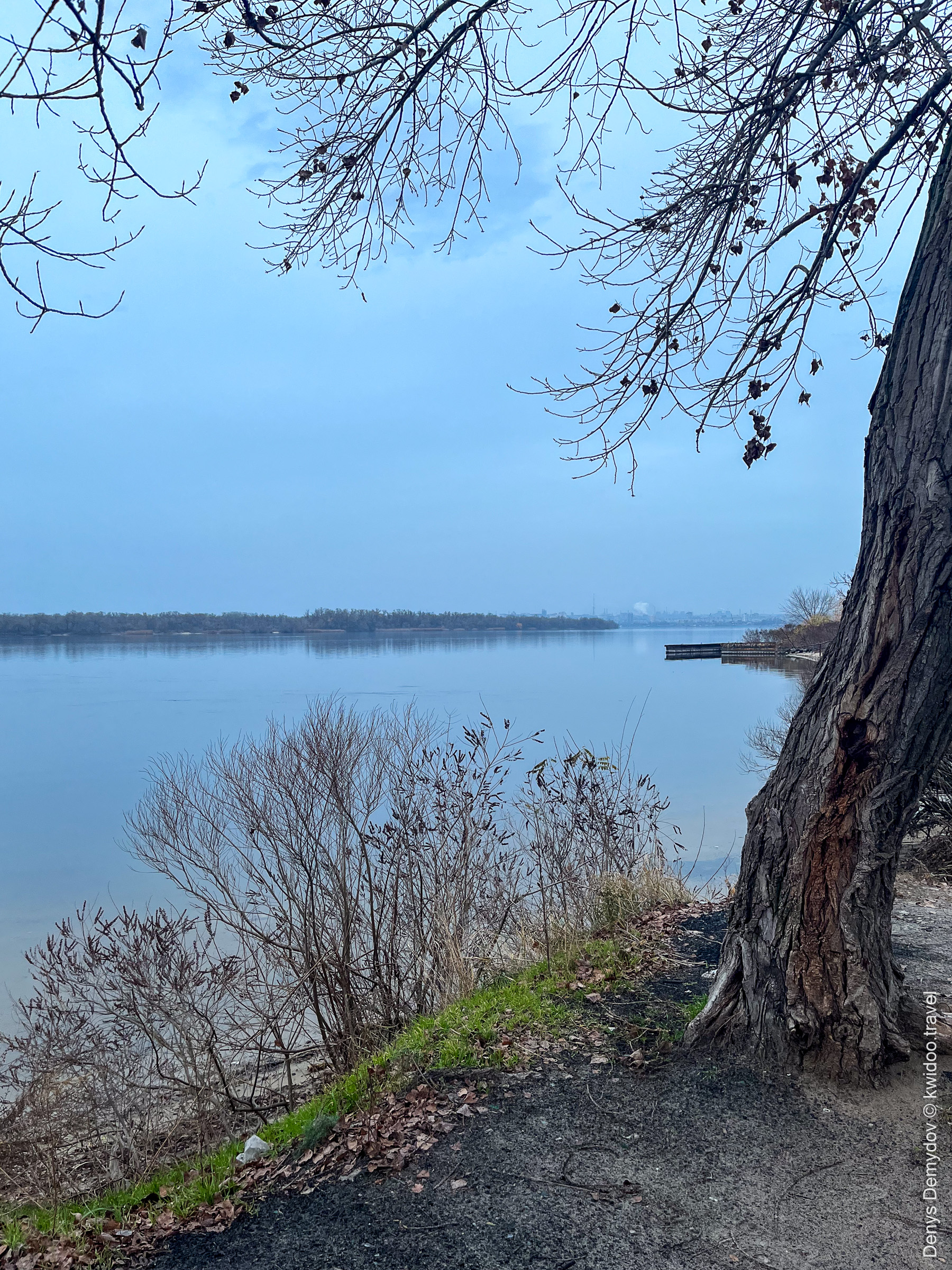
The floodplains in my city of Zaporizhzhia have become my favorite place to spend time since I discovered them in 2014. Back then, I bought a new bike and rode off into the unknown, suddenly discovering a piece of untouched nature just a few kilometers from my home. Here, in the remains of the Great Meadow, once flooded during the construction of the Kakhovka hydroelectric power station, I can spend hours enjoying the birdsong and the refreshing coolness of the shade of the trees from the scorching steppe sun, at the water’s edge.
It was easy to get here on foot, by car, or by bike. And it was also nice to paddle through the narrow channels in a kayak, imagining you were in the jungle…
And despite the outbreak of full-scale war, even though the front line was only a few dozen kilometers away, I enjoyed coming here: I would look at the water and feel calm, even though the birdsong was constantly interrupted by the sounds of artillery shells exploding and machine-gun fire.
In mid-January 2023, the Dnieper River began to rapidly recede. Given the number of artificial reservoirs and hydroelectric power plants on its banks, which significantly altered the landscape along its entire length, it was extremely difficult to determine who was responsible. Ukraine accused Russia [1], and Russia — Ukraine. Everyone had different opinions about who was draining the Dnieper and for what purpose.
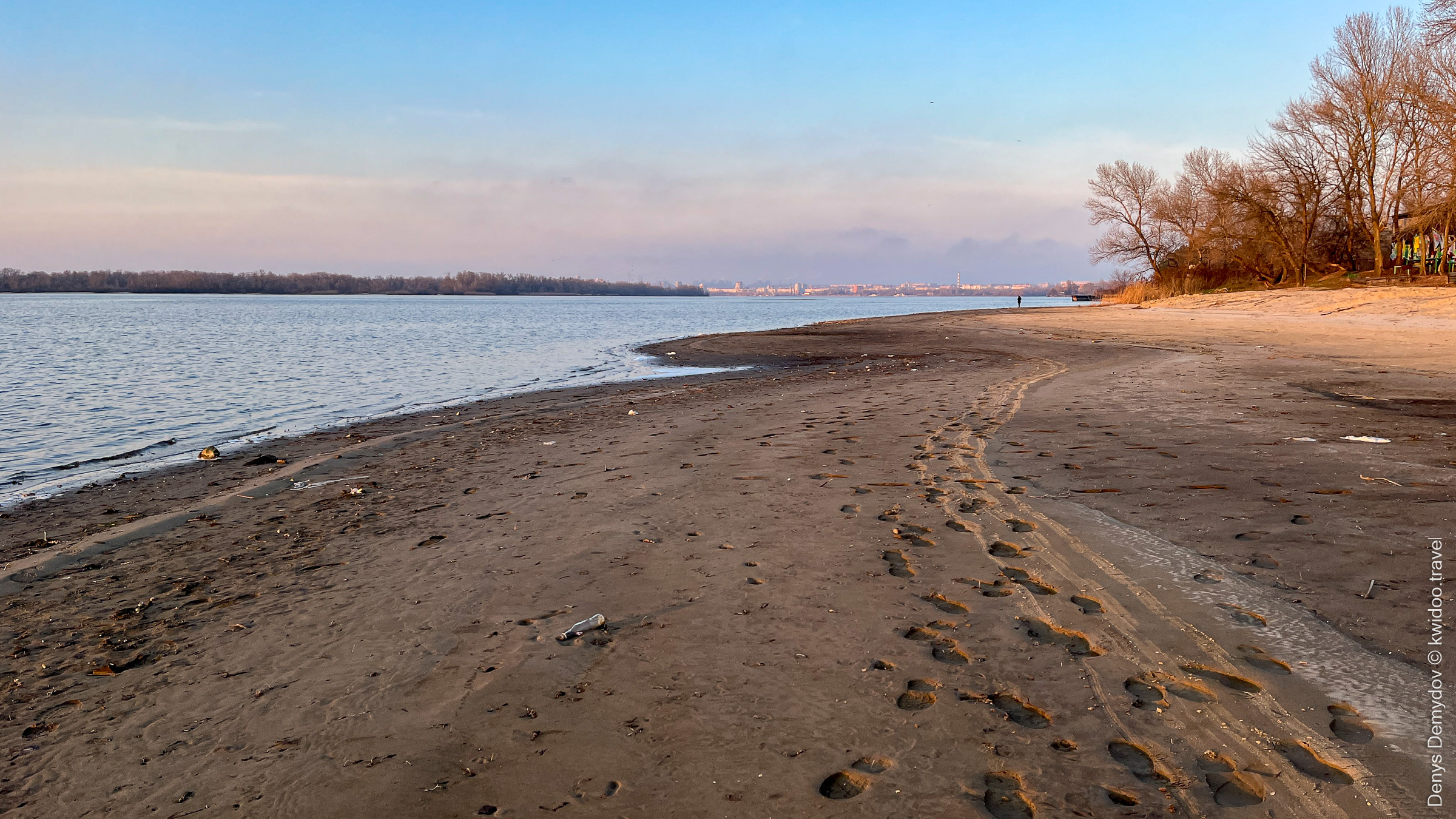
However, the fact remained. Whereas previously the coastline in this area might have shifted by a meter or so over the course of a year, I arrived one fine day and discovered that the water had receded 10–15 meters from the point I knew.
However, the fact remained. Whereas previously the coastline in this area might have shifted by a meter or so over the course of a year, I arrived one fine day and discovered that the water had receded 10–15 meters from the point I knew.
For your interest, I will show you a photograph taken two weeks earlier. In it, you can see that the water was exactly where the trees end. Everything that is now the shore was under the thick waters of the Dnieper.
At first, I couldn’t believe my eyes. After all, there was water here. This is where I fell through the ice a year ago while trying to take a nice photo. This is where my classmates and I had a picnic.
And suddenly—you still have to walk and walk to the water’s edge!
In the summer of that same year, tragedy struck: the dam at the Kakhovka Dam burst, and hundreds of tons of water rushed downstream, flooding Kherson and the surrounding area. I think that the release of water helped to significantly reduce the number of casualties and the extent of the damage. At the same time, in Zaporizhzhia, the Dnieper became even shallower, the relief changed, and the famous Dnieper rapids that gave the city its name (the literal translation of the name is “beyond the rapids”) came to the surface. To understand the scale of this, I recommend looking at my photo report on the cleanup of new areas of Khortytsia Island after the shallowing.
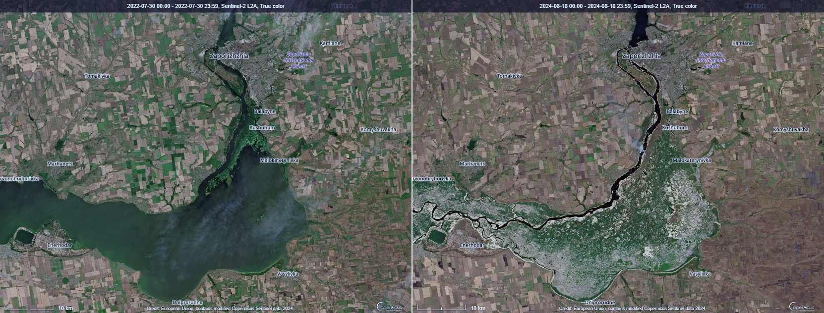
As you can see from the photos taken from space, we have returned to the landscape that existed here a hundred years ago, during the hunting season in the forests of the Great Meadow, which I wrote about in my article on Popov’s castle in Vasylivka. After the war, I really want to explore these lands, which are unknown to my contemporaries, although for a long time it will be dangerous due to the possible presence of mines and ammunition.
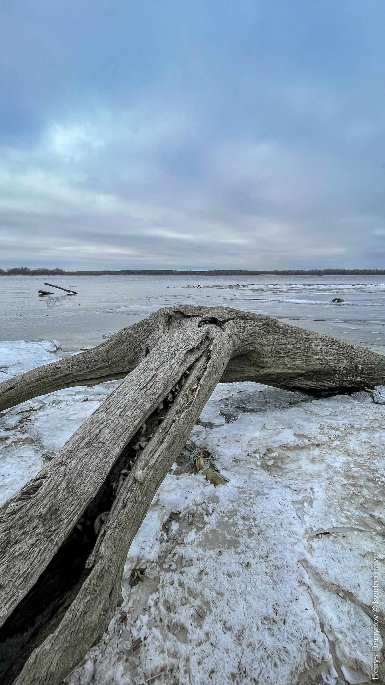
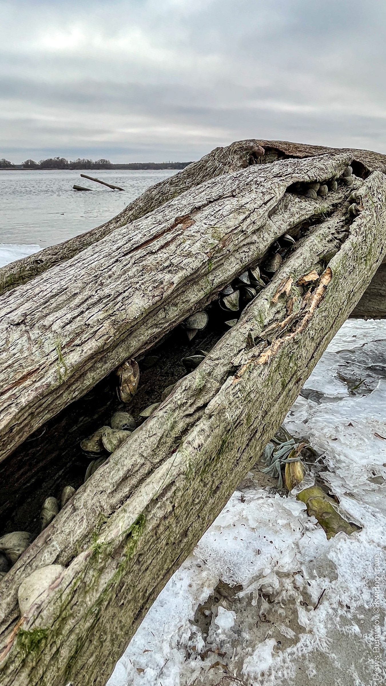
At that time, even walking along the protruding meters seemed like something fantastic. It was like beachcombing in the face of an impending man-made disaster. Especially if you looked closely at the details.
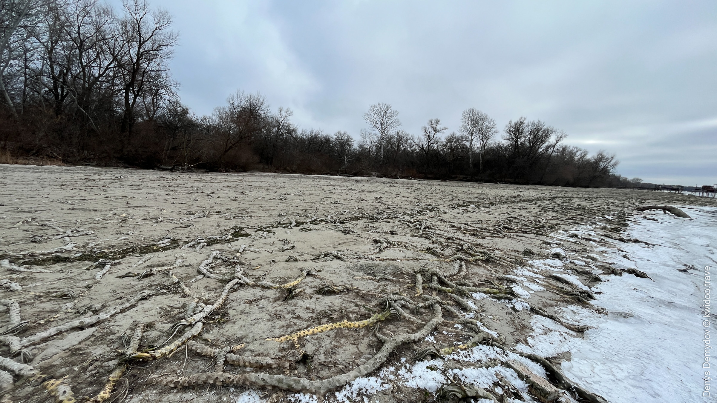
For example, in the photos above, there is an old tree that has been underwater for a long time. Not only has it been preserved very well, but it has also become a shelter for various river mollusks: colonies of river mussels can be seen inside the crevices.
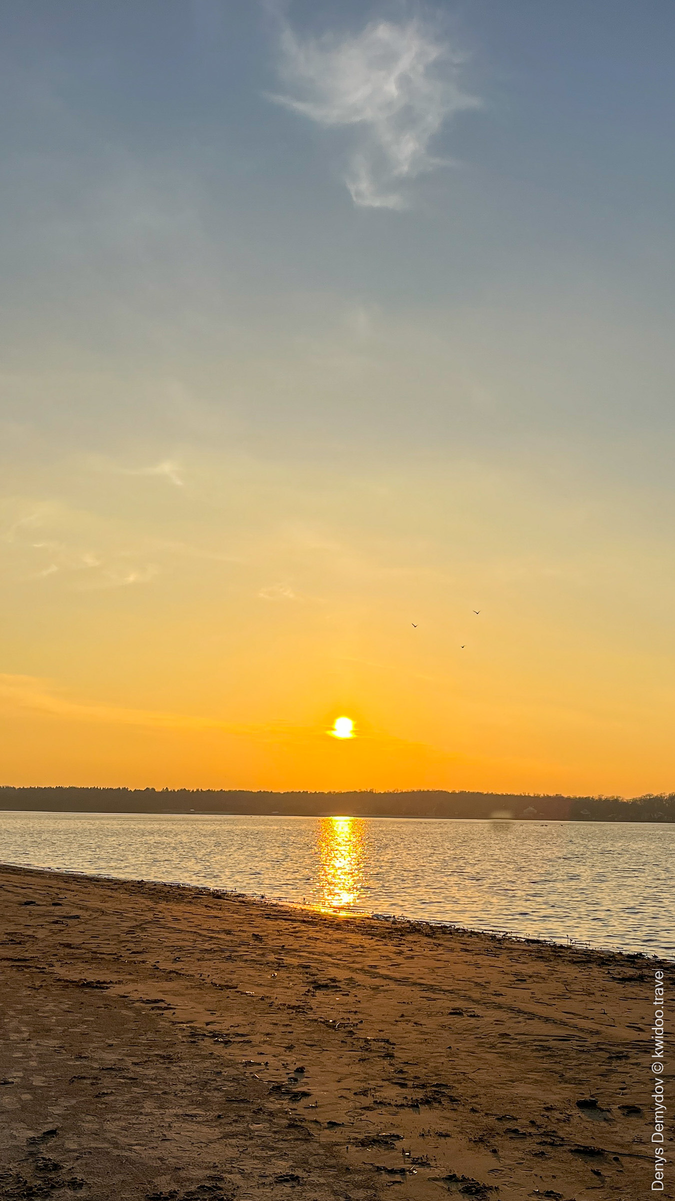
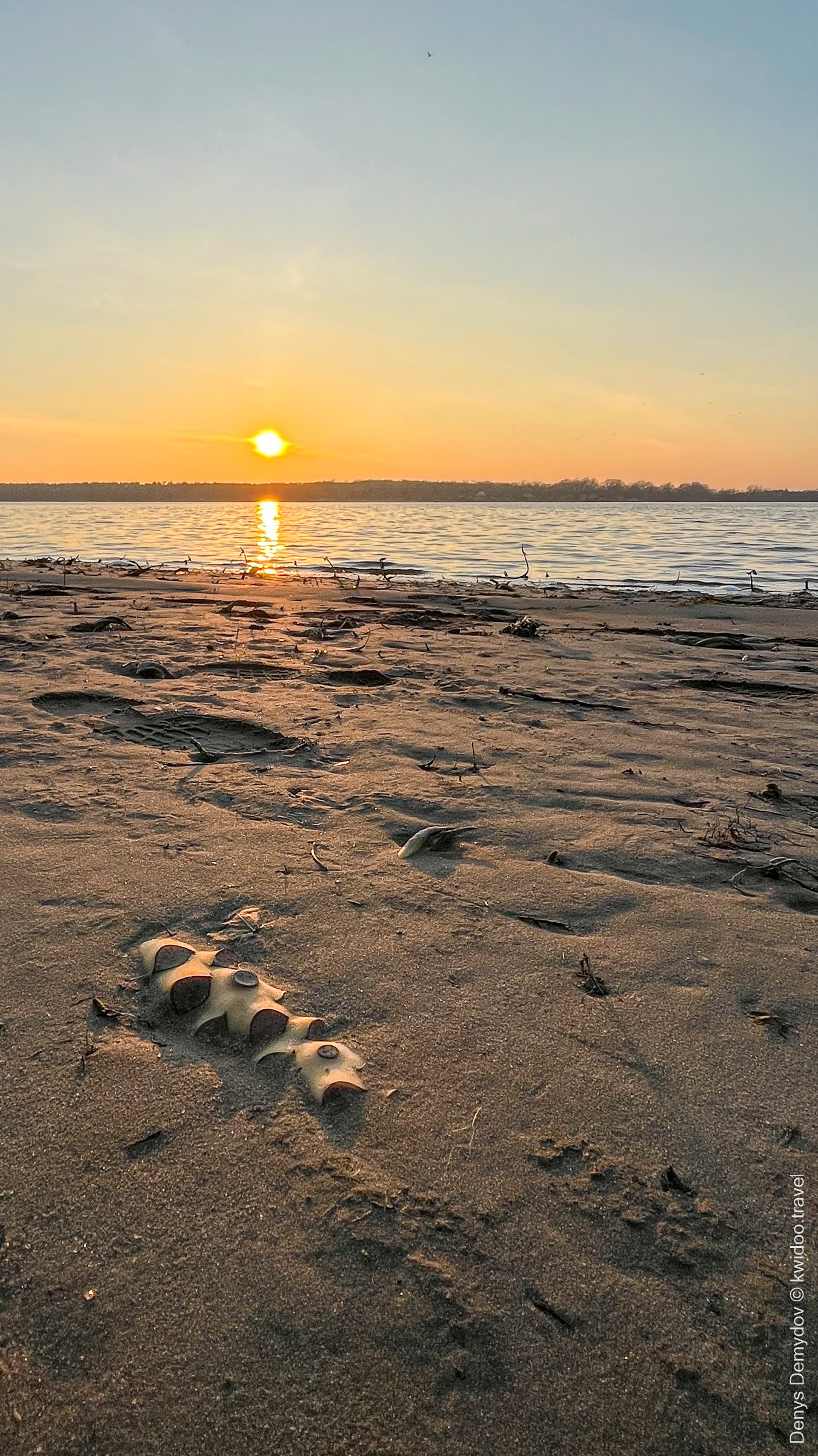
Or here, on the luxurious sunset coast a few days earlier, before the frosts hit. Zooming in, we see numerous intertwined roots, as in the photos at the beginning of the article, only closer up. It looks like tree branches chopped down with a machete.
Overall, walking through these fantastic landscapes is also an interesting experience. For those who love nature, it will be very interesting and informative. I believe that after the war, we will walk there many more times.
о
- BBC. (2023, March 23). Росія спеціально осушує Каховське море? Міфи і факти про можливу екологічну катастрофу . BBC News Україна. https://www.bbc.com/ukrainian/articles/c884jpv71w1o
[↩]